How I Created The Maps For My Novels About the Fall of Rome
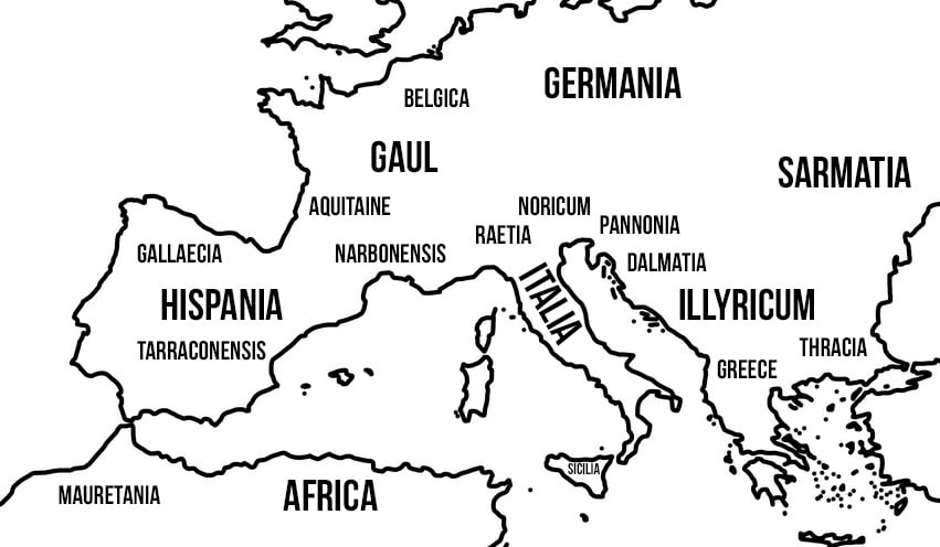
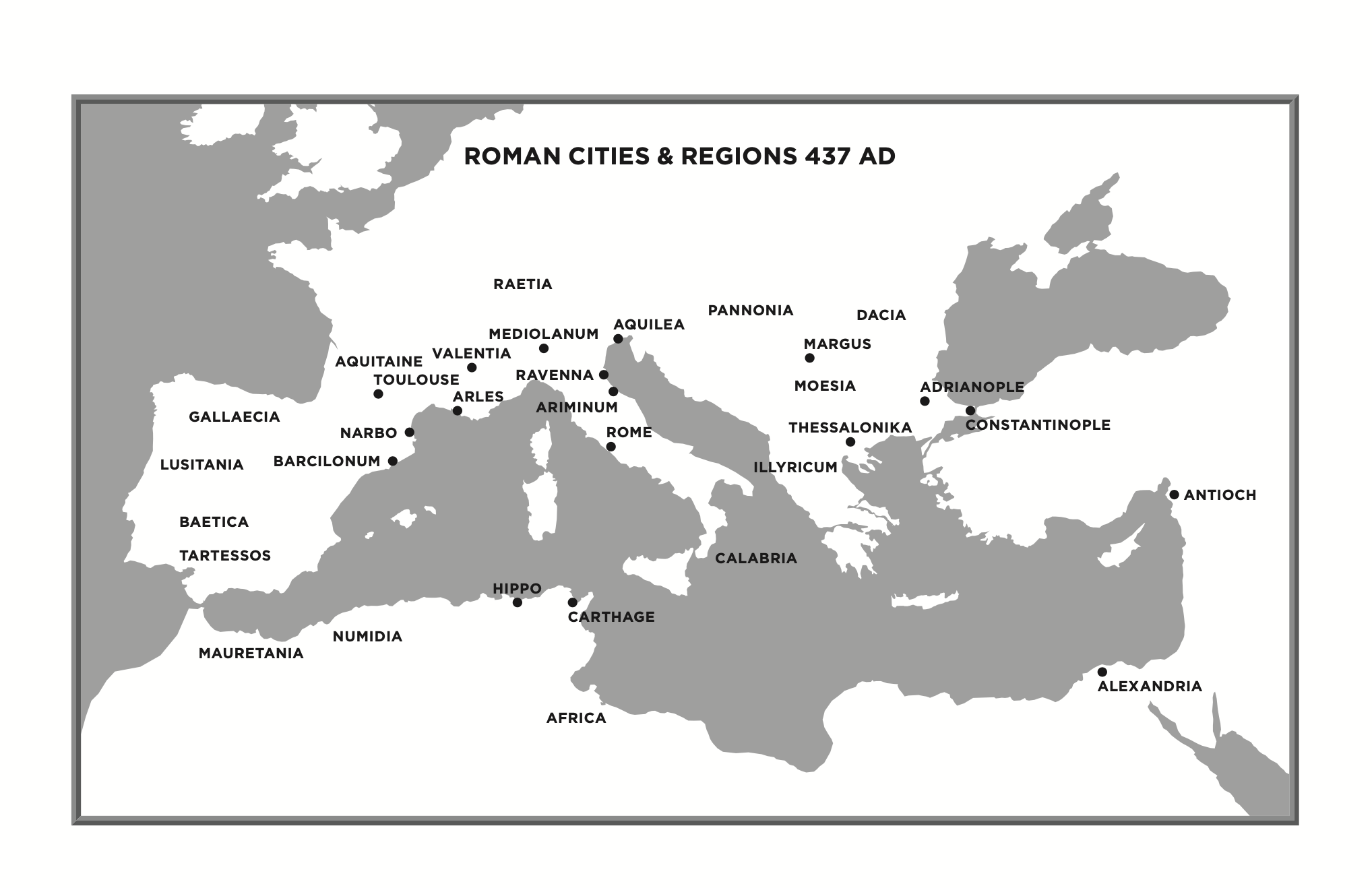
My novels include maps. I believe maps are important to help readers who are not familiar with the geography of the 5th century Roman Empire. In my books I use the 5th century place names, many of which will be unfamiliar to 21st century readers. For example, most readers will know that Gaul was the 5th century name for modern France, but few will know that Noricum was the Roman name for modern Austria.
To create these maps I use the services of a cartographer, but even the best map makers cannot create a map of a place they know nothing about. Therefore, as an author, I have to provide the cartographer with a rough sketch of the maps I need.
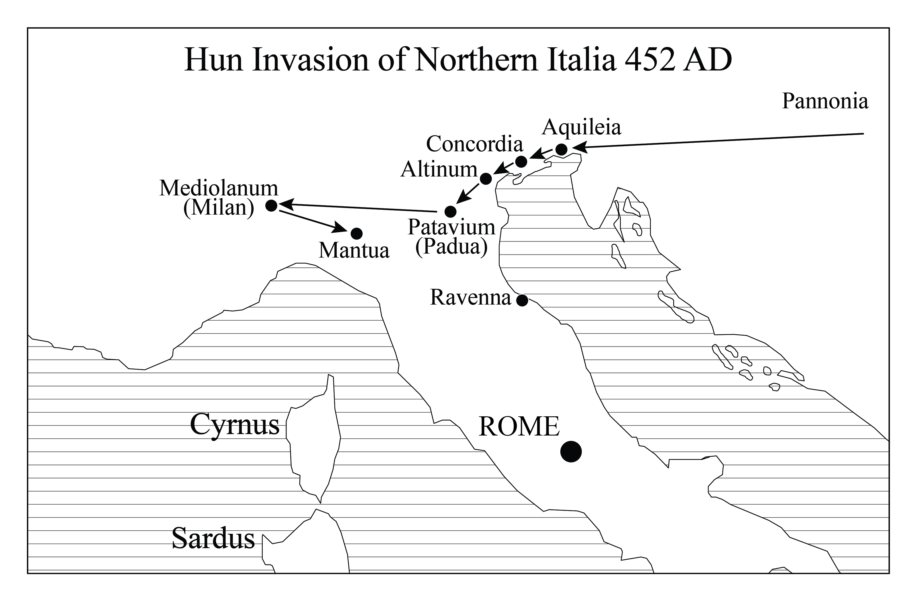
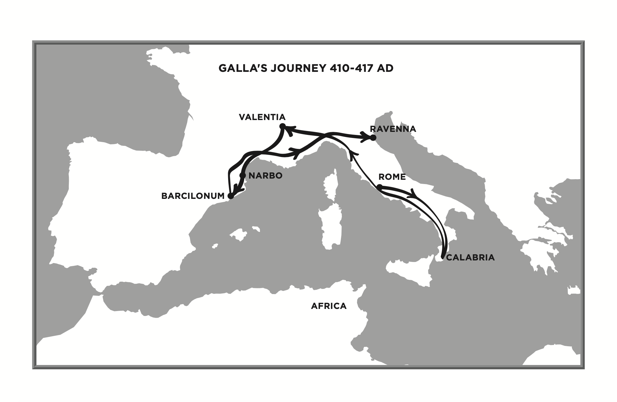
Some of my maps are simple geographical maps, showing Western Europe with the 5th century Roman provinces in the correct locations. But others show the paths taken by characters in their journeys. One of the more challenging maps I had to come up with was a map of the Huns’ invasion route as they moved west across central Europe into Gaul. To construct this map, I had to locate each town the Huns sacked along the way, and there were a lot of them. Then I had to figure out what they’re called today.
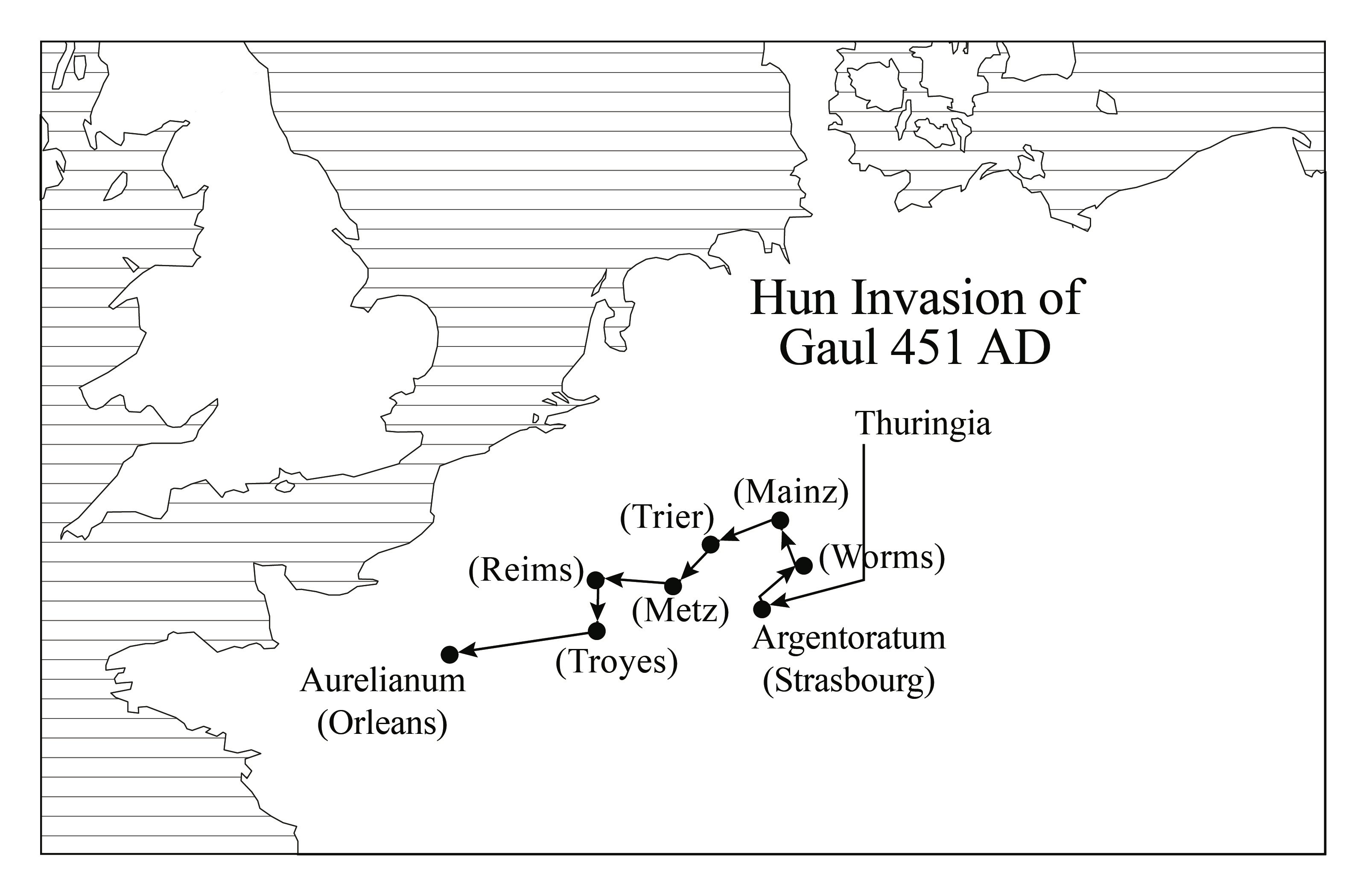
The town names in the sources are 5th century Latin names, not modern names. For example, the Roman town Augusta Treverorum is the modern day city of Trier, Germany. So, to find the locations on a modern map of Europe, I had to translate each Roman name into its modern day equivalent, then pinpoint each on a blank map of Europe before handing it over to the cartographer.
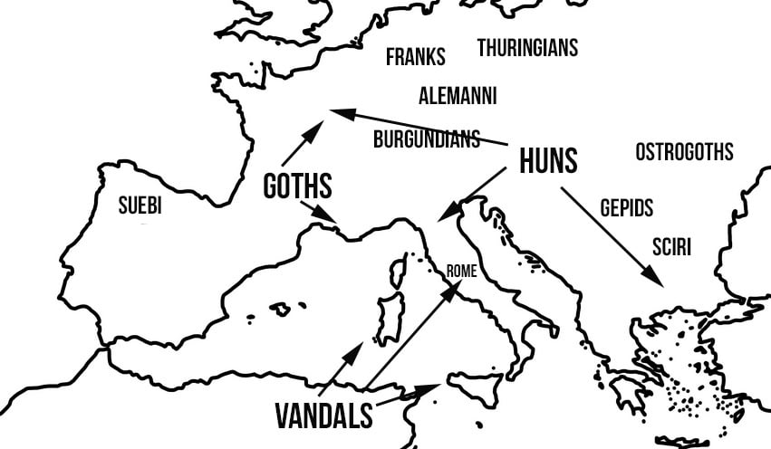
Fortunately, I find this kind of research fascinating. I have always loved maps and am particularly interested in the historical movements of people across topography. Migration has always been part of the human condition and to uncover how and why these people encountered each other and blended together tells an interesting story that relates directly to genealogy, which is the story of where we all came from.
Once my cartographer has the maps, he creates a more refined version of each and sends them back to me for adjustments. My adjustments might take the form of moving the locations slightly or correcting the spelling. If the map depicts a journey with arrows, I might have to bend the arrow in a certain way to better reflect the route taken. Then I send the maps back to the cartographer, who implements the corrections and sends them back to me for final approval.
The maps that appear in my novels help readers to better envision the canvas on which the epic tale I’m telling occurs. Like the footnoted glossary terms that translate the Roman terminology into modern English, or the pronunciation notes for the names of Roman characters, the maps are a way to assist modern readers in understanding the milieu of my novels without sacrificing the authenticity of the time and place I’m writing about.
If you haven’t yet started the journey through the last half-century of the Roman Empire as recounted in my novels, start here with The Wind in the Embers and prepare to embark on a thrilling passage through the people and places that make up one of the most consequential periods in world history.